Photo: NOAA-
Metropolis Desk –
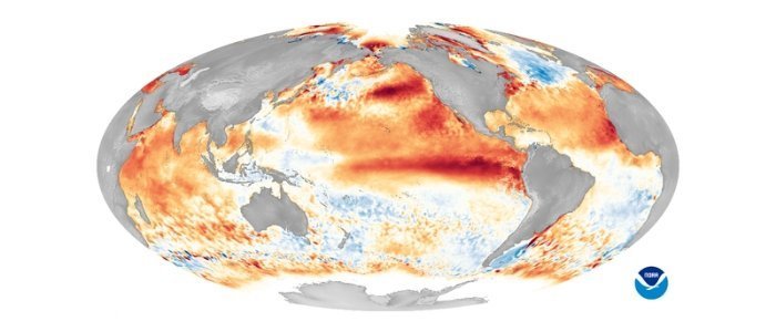
In the Pacific Ocean, an El Niño-type weather phenomenon has started. This will probably add heat to a globe that is already warming due to climate change.
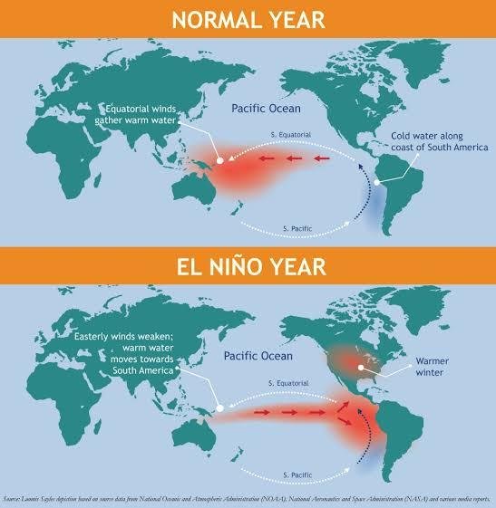
The term El Niño (Spanish for ‘the Christ Child’) refers to a warming of the ocean surface, or above-average sea surface temperatures, in the central and eastern tropical Pacific Ocean.
Warmer water in the Pacific Ocean is often pushed towards the west side of the ocean by winds, but when El Nio occurs, these winds weaken, allowing the warmer water to drift back towards the east and spread out across a broader area of the ocean. More moisture-rich air rises above the warmer ocean as a result, changing the way air circulates in the atmosphere all across the world. This often results in a colder, drier winter in North America’s northern regions, such as Canada, while the southern states and Gulf Coast have a more humid winter.

El Niño is expected to make 2024 the hottest year on record, according to experts. Scientists have already warned that the globe has a 66 percent risk of exceeding the crucial 1.5-degree Celsius global warming limit at least once between now and 2027 due to growing emissions and a severe El Nio.
This winter, it may also bring populations in the US and abroad harmful extreme weather, such as torrential rain and flooding. Additionally, it will have an impact on the global climate, possibly bringing Australia’s monsoon season to an end and increasing rainfall in the southern US.
Up until next spring, when its effects will probably start to fade, the event will probably continue.
Source- BBC


